Our Purpose
Wildfires, whether started by nature or humans, have a tremendous impact on our environment, health, and lives. According to WHO, they disrupt communication, transportation, gas services, power and water supply, etc. Even for those who live far away, wildfires can still endanger them with their smoke. Particle pollution from wildfires trigger heart attacks, strokes, and can kill. A large portion of wildfires originated from human activities by mistakes, including careless debris-burning, negligence on campfires, heat sparks from cars starting up, etc.
Our goal is to inform citizens and government officials about how quickly wildfires can spread. By increasing awareness of consequences, we are equipped to reduce future occurrences of wildfires. This could also help the fire departments extinguish wildfires more efficiently by showing common trends about how the fires spread and the factors that influence this trend.
In this project, we are visualizing the wildfires that have occurred on the west coast of the United States. As residents of the state of Washington, we have experienced the effects of these wildfires more and more each year. Especially during the summer, smokey conditions have become a pressing issue. Oftentimes, the smoke in Washington originated from a fire from Oregon or California, which the wind currents carried to Washington. Thus we chose to analyze wildfire trends for the entire west coast.
Our Process
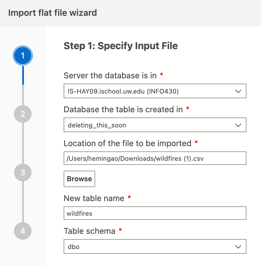
Import data
We decided to first clean data in CSV format, then convert it to a GeoJSON file to later visualize it with MapBox. Imported data becomes a table named “wildfires.”
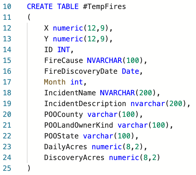
Create temporary table
We created a temporary table to clean data without fear of messing up the original file.
Insert data
Then we inserted “wildfires” data into this temporary table while filtering for California, Oregon, and Washington.

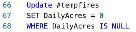
Handle nulls
Nulls in this dataset indicate “no area burned,” so we updated them to zero.
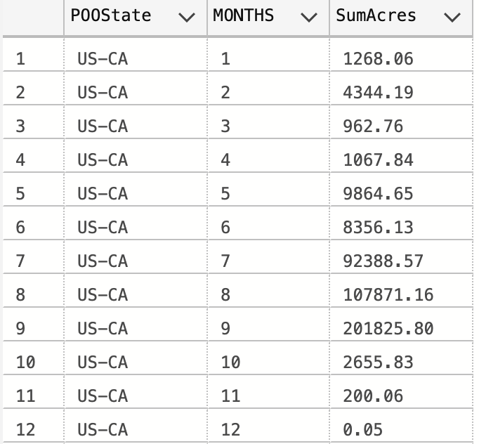
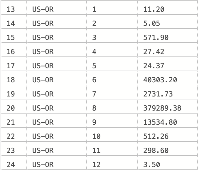
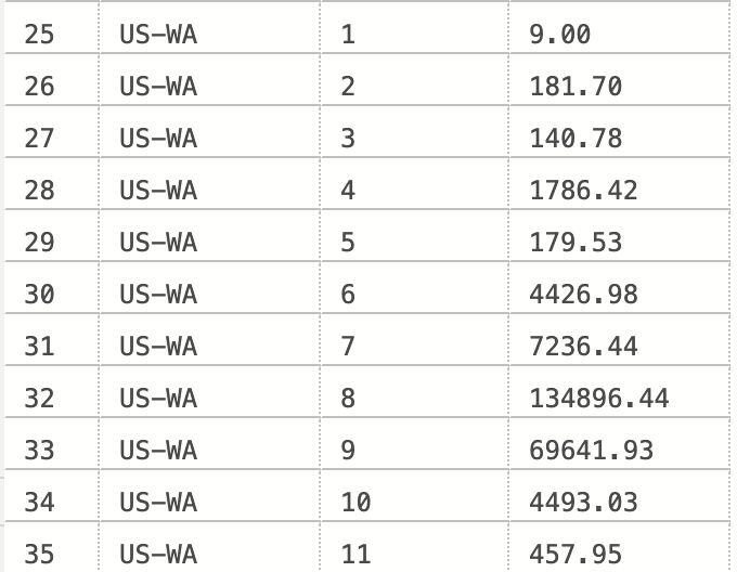
Aggregate values
We used the MONTH() function and GROUP BY statement to display the cumulative amount of acres burnt in each state for each month.

Results
So far in December, there hasn’t been an instance of wildfire in Washington State, so we obtained one less row of data.